The Planning and Community Development Department administers the Town’s planning, zoning, and building regulations. The Zoning Regulations determine what property owners are allowed to do with their land. The Town’s land use regulations can be found in the Town of Ridgeland SmartCode. This page provides a variety of resources about the Town’s zoning ordinances.
Ridgeland’s zoning code is a modified version of the SmartCode. It is a zoning code which categorizes land into different ‘transects’ based on the density of development. For example, an area of preserved woodlands would be categorized under Transect 1 (T1), which legally restricts almost all development in that zone. Suburban areas are typically zoned T3, which allows for lower-density residential development. Ridgeland’s downtown area is generally zoned under higher-density residential and commercial zones like T4 and T5. To learn about what is allowed in each Transect in Ridgeland, see Article 6, Table 2 of the SmartCode.
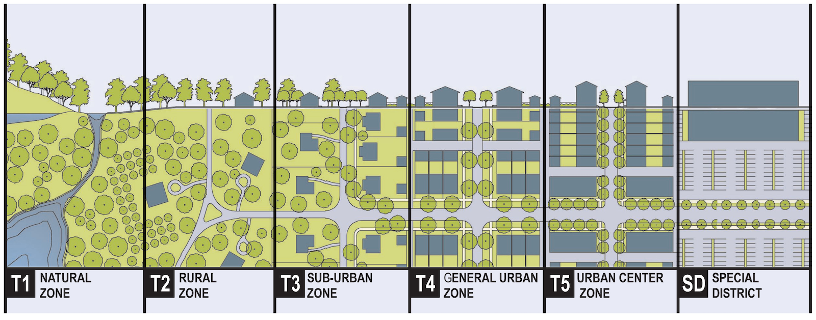
The transects as they appear in the SmartCode, Article 6, Table 2.
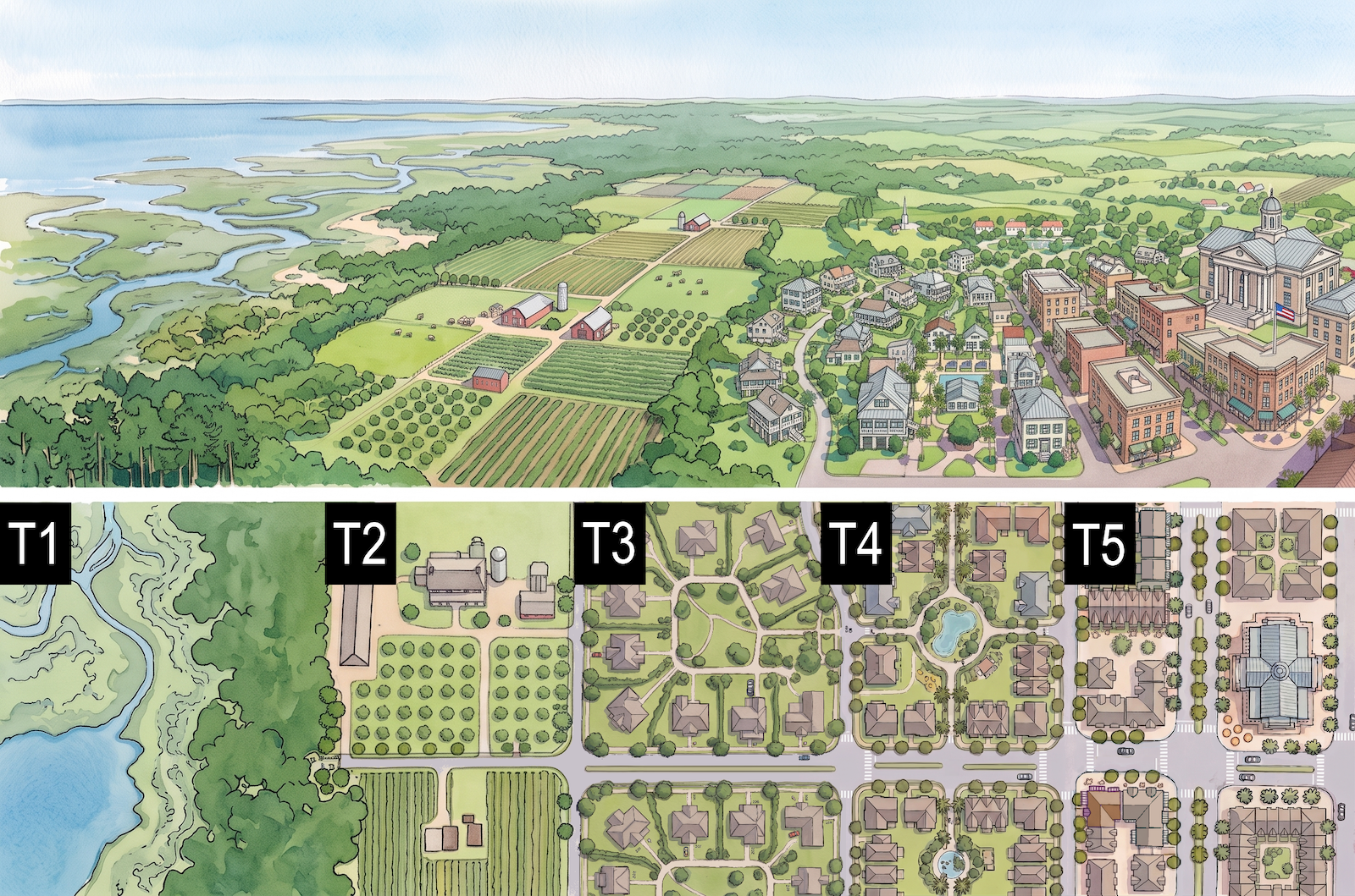
The transects visualized to show the desired development patterns for Ridgeland.
The Town of Ridgeland recently updated its Comprehensive Plan in 2025. The Comprehensive Plan is the Town’s vision for its future, including the Town’s vision for future development. It places heavy emphasis on downtown reinvestment and controlled growth. It also includes extensive information about the Town’s Growth Map/Future Land Use Map and Sector Map. It is highly recommended that developers read the Comprehensive Plan to understand how their projects can fit in with the Town’s broader plan for its future.

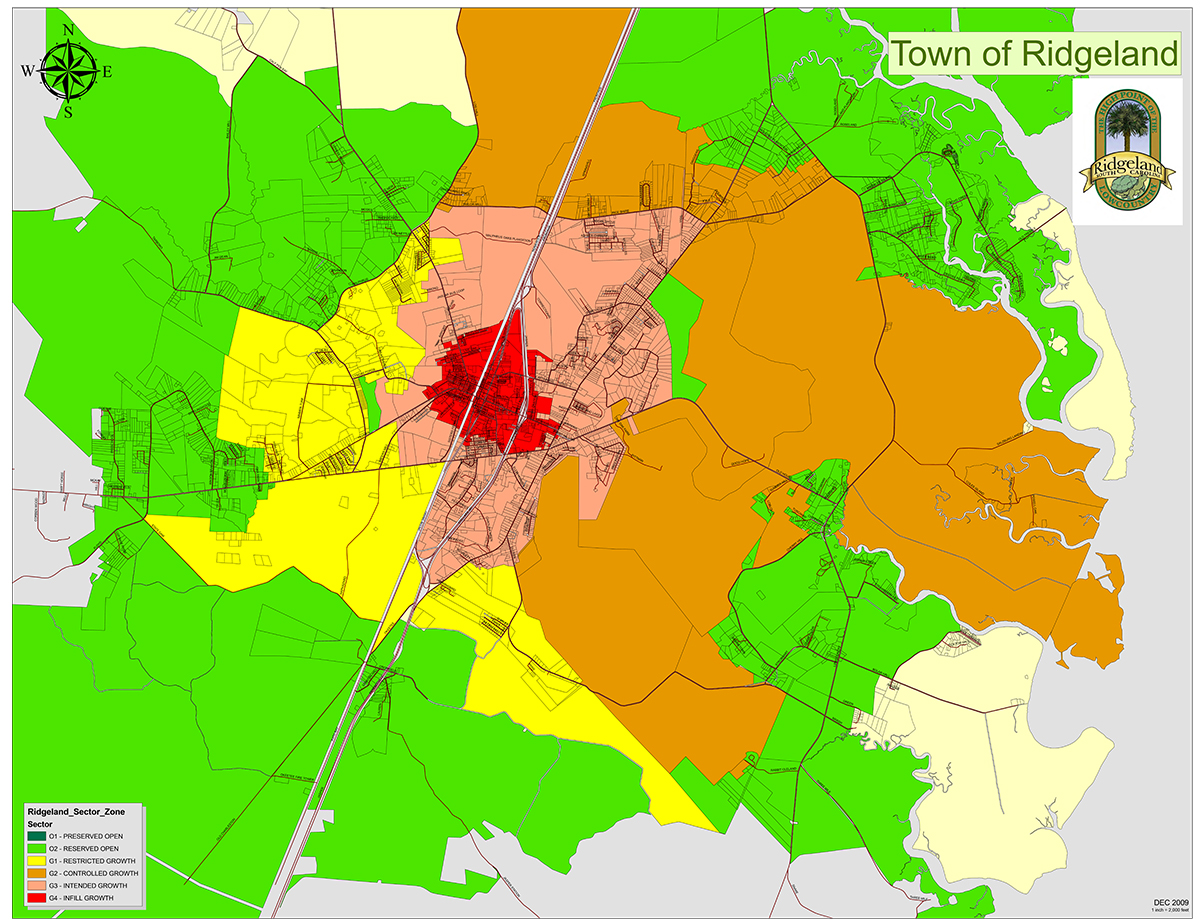
The Growth Map represents the way in which the Town would like land to be used in the future. It provides direction as to where the Town wishes to direct new growth, where the Town wants to see infill development, and where the Town wishes to restrict growth (preserve rural environments). This map is particularly helpful when evaluating rezoning and annexation proposals. It is not mandatory but a preferred direction. See pages 28 and 32–39 of the Comprehensive Plan.
This map is used to determine, among other things, the extent to which Ridgeland wishes to grow as a Town. This map is particularly helpful when evaluating rezoning and annexation proposals. It is not mandatory but a preferred direction. See Page 107 of the Comprehensive Plan.
The Town runs its own water and sewer utilities that are separate from the Beaufort Jasper Water Sewer Authority (BJWSA). The location of water and sewer lines is particularly important for new developments, as the Town requires that new developments be annexed into the Town of Ridgeland to receive the Town’s water and sewer services. Contact the Water and Sewer Department or the Planning and Community Development Department if you have any questions or need more information.